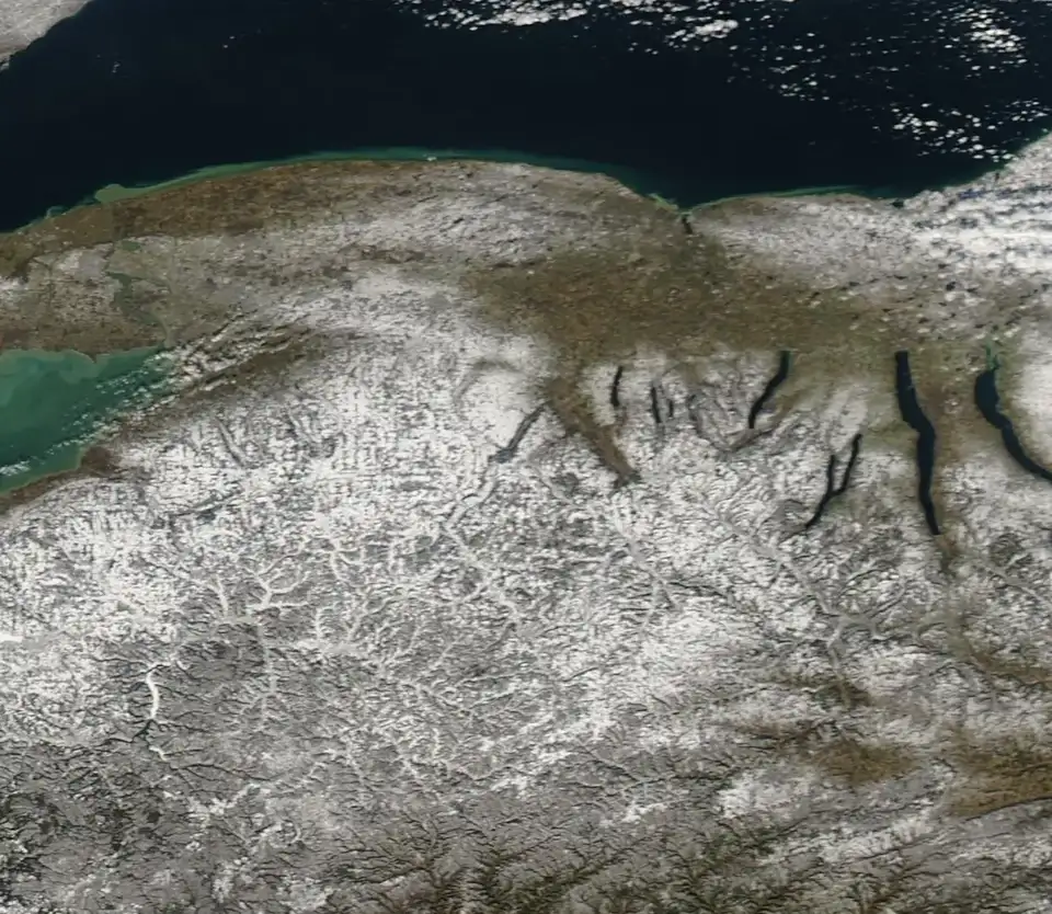
Every verified place and upcoming event with a confirmed location, on one live map of the Finger Lakes and the Southern Tier. Filter by town, type or date, or search by name. Click a marker for the address, hours, the source, and directions.
Skip to the list of places This map needs JavaScript. Browse the Hornell directory , the Canisteo directory , or the town guides instead.
10-10 BBQ & Catering, 10-10 BBQ Brewing Co. Moravia · 5 Adams St, Moravia, NY 13118 1911 Established Lafayette · 4473 CHERRY VALLEY TPKE, Lafayette, NY 13084 1911 Established Lafayette · 2706 LORDS HILL RD, Lafayette, NY 13084 1927 Brew House and Distillery Buffalo · 7800 Transit Rd, Buffalo, NY 14221 20 Deep Winery LLC Honeoye Falls · 187 MENDON IONIA RD, Honeoye Falls, NY 14472 4 Kings Distillery, LLC Newfane · 2712 West Ave, Newfane, NY 14108 42 North Brewing Company LLC East Aurora · 25 PINE ST, East Aurora, NY 14052 7 Sins Brewery Westfield · 14 16 N PORTAGE ST, Westfield, NY 14787 7-Eleven – Canisteo Street Hornell · 315 Canisteo Street, Hornell, New York 14843 7-Eleven – Seneca Street Hornell · 51 Seneca Street, Hornell, New York 14843 8443 Spirit Run Naples · 8443 SPIRIT RUN, Naples, NY 14512 A Gust of Sun Ransomville · 4515 BAER RD, Ransomville, NY 14131 Aarons Hornell · 16 Park Drive, Hornell, New York 14843 Abandon Brewing Company Penn Yan · 2994 MERRITT HILL RD, Penn Yan, NY 14527 Abbie & Gadazel Winery LLC Victor · 6802 Valentown Rd, Victor, NY 14564 Abbott’s Wine & Cidery LLC Baldwinsville · 3275 COLD SPRINGS RD, Baldwinsville, NY 13027 Acquilano Wine Cellars LLC Canandaigua · 5797 SMITH RD, Canandaigua, NY 14424 Adult Career and Continuing Education Services (ACCES-VR) Hornell · 107 Broadway, Hornell, New York 14843 Affordable Veterinary Service Hornell · 181 Seneca Street, Hornell, NY 14843 Agent Nancy Healthy Insurance Solutions Hornell · 96 Main Street, Hornell, New York 14843 Agness Wine Cellars LLC Pulteney · 14157 W LAKE RD, Pulteney, NY 14840 Agricolae Estate Winery by Ravines Hammondsport · 13920 State Route 54, Hammondsport, NY 14840 Airy Acres Vineyard Interlaken · 8011 FOOTES CORNERS RD, Interlaken, NY 14847 AJ’s Corner Convenience Store Hornell · 31 Main Street, Hornell, New York 14843 Alfred Alfred Alfred State College Alfred Alfred University Alfred Alistair’s Distillery Lodi · 2513 COVERT RD, Lodi, NY 14860 Allegany Eye Associates Hornell · 34 Broadway Mall, Hornell, New York 14843 Alleyway Redemption Hornell · Brickman Lane, Hornell, New York 14843 Allison Watt at Angela’s Hair Zoo Hornell · 47 Maple St, Hornell, NY 14843 Alma Ayer at Eibert Vineyards Skaneateles · 2252 EIBERT RD, Skaneateles, NY 13152 Amalena Jamestown · 1034 Allen St, Jamestown, NY 14701 Amber Lantern Brewing Company Warsaw · 44 N MAIN ST, Warsaw, NY 14569 American Cider Company Buffalo · 1430 1500 CLINTON ST, Buffalo, NY 14206 AmeriCorps Seniors of Steuben County Hornell · 20 Broadway Mall, Hornell, New York 14843 AMVETS Post 245 Hornell · 28 Broadway Mall, hornell, New York 14843 Andolina Dental, PC Hornell · 74 Main Street, Hornell, New York 14843 Andy’s Sub Shop Hornell · 32 Seneca Street, Hornell, NY 14843 Angela Yanni at Angela’s Hair Zoo Hornell · 47 Maple St, Hornell, NY 14843 Angela’s Hair Zoo Hornell · 47 Maple Street, Hornell, New York 14843 Anheuser-Busch Baldwinsville · 2885 BELGIUM RD, Baldwinsville, NY 13027 Anthony Manor Sanborn · 3671 HUMAN RD, Sanborn, NY 14132 Anthony Road Wine Co. Inc. Penn Yann · 1020 ANTHONY RD, Penn Yann, NY 14527 Anyelas Vineyards Skaneateles · 2433 WEST LAKE ROAD, Skaneateles, NY 13152 Apollo’s Praise Ovid · 7448 County Rd 153, Ovid, NY 14521 Apple Barrel Orchards Penn Yan · 2673 SAND HILL RD, Penn Yan, NY 14527 Applebees Grill & Bar Hornell · 1006 State Route 36, Hornell, NY 14843 Arbor Housing office Hornell · 30 Seneca Street, Hornell, New York 14843 Arc of Steuben Hornell · 42 Seneca Street, Hornell, New York 14843 Ardennes Brewing LLC Geneva · 570 SNELL RD, Geneva, NY 14456 Ardesia Winery Tully · 1079 STEVENS RD, Tully, NY 13159 Arkport Arkport Arrow Maker Spirits Branchport · 2982 GUYANOGA RD, Branchport, NY 14418 Arrowhead Spring Vineyards LLC Lockport · 4746 TOWNLINE RD, Lockport, NY 14094 Atwater Vineyards, LLC Burdett · 5055 NY ROUTE 414, Burdett, NY 14818 Aubergine Bed & Breakfast Penn Yan · 311 Clinton St, Penn Yan, NY 14527 Aurora Brewing Co. King Ferry · 1891 State Route 90 N, King Ferry, NY 13081 Autark Brewhouse LLC Buffalo · 420 AUBURN AVE, Buffalo, NY 14213 Autozone Hornell · 960 State Route 36, Hornell, New York 14843 Autumn Moon Farm Winery Bergen · 7585 W BERGEN RD, Bergen, NY 14416 Azure Hill Winery Hammondsport · 8716 GALLAGHER ROAD, Hammondsport, NY 14840 B & B Repair Services Canisteo · 4 Second Street Canisteo NY 14823 B&E Ciderworks LLC Palmyra · 1087 Yellow Mills Rd, Palmyra, NY 14522 Ball Vineyards LLC Trumansburg · 4204 Krums Corner Rd, Trumansburg, NY 14886 Barbichette Dundee · 74 Seneca St, Dundee, NY 14837 Barn Dog Craft Distilling E Aurora · 1851 FOUR ROD RD, E Aurora, NY 14052 Barnstormer Winery Rock Stream · 4184 RTE 14, Rock Stream, NY 14878 Barrel Factory Distilling Buffalo · 65 VANDALIA ST, Buffalo, NY 14204 Barrel Necessities LLC Canandaigua · 5501 STATE RTE 21, Canandaigua, NY 14424 Barrelhouse 6 Distillery Hammondsport · 9558 MIDDLE RD, Hammondsport, NY 14840 Barrington Distillers Dundee · 5040 BILL BAILEY RD, Dundee, NY 14837 Bath Bath Bath National Cemetery Bath Battle Street Brewery LLC Dansville · 4 BATTLE ST, Dansville, NY 14437 Bc Farm Wnry & Barrington Cellars Penn Yan · 2690 GRAY ROAD, Penn Yan, NY 14527 Bee Spit Meadery LLC South Wales · 7286 OLEAN RD, South Wales, NY 14139 Beer Justice Brewing Co. Arcade · 3 HURDVILLE RD, Arcade, NY 14009 Beer Tree Brew Johnson City · 511 REYNOLDS RD, Johnson City, NY 13790 Beer Tree Brew Co. Port Crane · 197 STATE RTE 369, Port Crane, NY 13833 BelCliff Distilling, LLC Belfast · 41 S Main St, Belfast, NY 14711 Belhurst Estate Winery Inc. Romulus · 5525 E LAKE ROAD, Romulus, NY 14541 Bella Rose Vineyard & Winery LLC Lewiston · 1243 RIDGE RD, Lewiston, NY 14092 Bellwether Hard Cider Trumansburg · 9070 ROUTE 89, Trumansburg, NY 14886 Belt Line Brewery & Kitchen Buffalo · 545 SWAN ST, Buffalo, NY 14204 Best Bev LLC Waverly · 685 Broad Street Ext, Waverly, NY 14892 Best Western – Maple City Inn Hornell · 1 Canisteo Street, Hornell, New York 14843 BESTBUY Self Storage – Hornell Hornell · 200 Canisteo Street, Hornell, New York 14843 Bet the Farm Trumansburg · 4204 KRUMS CORNERS RD, Trumansburg, NY 14886 Big Alice Brewing Company LLC Geneva · 4180 State Route 14, Geneva, NY 14456 Big Ditch Brewing Company LLC Buffalo · 101 OAK ST, Buffalo, NY 14203 Big Ditch Brewing Company LLC Lockport · 1 East Ave, Lockport, NY 14094 Big Ditch Brewing Company LLC Buffalo · 55 E Huron St, Buffalo, NY 14203 Big Inlet Brewing Mayville · 6169 ELM FLATS RD, Mayville, NY 14757 Biggie’s Burritos, Bowls & Tacos Hornell · 66 River Street, Hornell, NY 14843 Billsboro Winery Geneva · 4760 W LAKE ROAD, Geneva, NY 14456 Billy Schu’s Food Grill Hornell · 15 Seneca Street, Hornell, NY 14843 Birdhouse Brewing Company Honeoye · 8728 MAIN ST, Honeoye, NY 14471 Birdseye Hollow Farm & Distillery Hammondsport · 8398 COUNTY RTE 96, Hammondsport, NY 14840 Birnbaum Vineyards Interlaken · 7953 Footes Corners Rd, Interlaken, NY 14847 Black Creek Cidery LLC Byron · 6885 WARBOYS RD, Byron, NY 14422 Black Diamond Farm LLC Trumansburg · 4675 SENECA RD, Trumansburg, NY 14886 Black Sheep Distillery Prattsburgh · 8059 COUNTY RTE 77, Prattsburgh, NY 14873 Black Sheep Inn Hammondsport · 8329 Pleasant Valley Rd, Hammondsport, NY 14840 Black Willow Winery LLC Burt · 5565 W LAKE RD, Burt, NY 14028 Blackduck Cidery Ovid · 3046 COUNTY RD 138, Ovid, NY 14521 Blackman Cider Co. Lockport · 4472 THRALL RD, Lockport, NY 14094 Blake’s Hard Cider Co. Wolcott · 6523 Dutch Street Rd, Wolcott, NY 14590 Blue Barn Cidery/Pomona Events Hilton · 928 MANITOU RD, Hilton, NY 14468 Blue Spring Imports Buffalo · 212 OHIO ST, Buffalo, NY 14204 Blue Toad Rochester · 120 MUSHROOM BLVD, Rochester, NY 14623 Blushing Rose Bed and Breakfast Hammondsport · 11 William St, Hammondsport, NY 14840 Body by Brian Gym Hornell · 181 Seneca Street, Hornell, New York 14843 Boland Thomas Vineyards, LLC Ovid · 3024 COUNTY RD 138, Ovid, NY 14521 Bones and Barley Brewing Company, Inc. Spencerport · 377 S Union St, Spencerport, NY 14559 Boom Point Williamson · 7483 SALMON CREEK RD, Williamson, NY 14589 Boston Hills Brewing Colden · 8282 COLE RD, Colden, NY 14033 Bounce Rentals Hornell · 135 Seneca Street, Hornell New York Boundary Breaks Vineyard Lodi · 1568 PORTER COVERT RD, Lodi, NY 14860 Boy Scouts of America Hornell · 20 Broadway Mall, Hornell, New York 14843 Bradley Supply Hornell · 29 Transit Drive, Hornell, New York 14843 Brandy’s Cup of Joe Hornell · 12 Maple Street, Hornell, NY 14843 Bravery Winery Penn Yan · 1020 ANTHONY RD, Penn Yan, NY 14527 Brazen Brewing Lancaster · 5839 GENESEE ST, Lancaster, NY 14086 Brewery @ Wetlands LLC Van Etten · 469 State Route 224, Van Etten, NY 14889 Briarbrothers Brewing Company Buffalo · 50 ELK ST, Buffalo, NY 14210 Brickyard and Brewing Company Lewiston · 432 CENTER ST, Lewiston, NY 14092 Bright Leaf Vineyard King Ferry · 1250 CLEARVIEW RD, King Ferry, NY 13081 Bristol Valley Vineyards Bloomfield · 7235 LANE RD, Bloomfield, NY 14469 Britesmith Brewery, Britesmith Brewing Buffalo · 1250 Niagara St, Buffalo, NY 14213 Britesmith Brewing Williamsville · 5609 5611 MAIN ST, Williamsville, NY 14221 Brows Amore Hornell · 17 Seneca Street, Hornell, NY Buffalo Brew Pub Williamsville · 6861 MAIN ST, Williamsville, NY 14221 Buffalo Brewing Company Buffalo · 662 FILLMORE AVE, Buffalo, NY 14212 Buffalo Brewing Company, LLC Buffalo · 314 MYRTLE AVE, Buffalo, NY 14204 Buffalo Distilling Company Inc. Buffalo · 860 SENECA ST, Buffalo, NY 14210 Buffalo Olde Brewery Buffalo · 1223 LOVEJOY ST, Buffalo, NY 14206 Buffalo Riverworks Buffalo · 359 GANSON ST, Buffalo, NY 14203 Builders Bargain Outlet Hornell · 1080 West Main Street Suite 113-114, Hornell, New York 14843 Bull’s Eye Saloon & Axe Throwing Hornell · 752 State Route 21, Hornell, NY 14843 Bullfrog Construction Hornell · 24 Maple Street, Hornell, New York 14843 Bullfrog Realty and Property Management LLC Hornell · 16-24 Maple Street, Hornell, New York 14843 Bully Hill Vineyards Hammondsport · 8843 GREYTON H TAYLOR MEM'L DR, Hammondsport, NY 14840 Burger King Hornell · 45 Main Street, Hornell, NY 14843 Buried Barrel Hard Cider LLC Castile · 6517 Denton Corners Rd, Castile, NY 14427 Butera’s, Jimmies Pizza Co. Hamburg · 32 MAIN ST, Hamburg, NY 14075 Buttermilk Falls State Park Ithaca Cake & Crumb Hornell · 13 McLean Avenue, Hornell, NY 14843 Canandaigua Wine Company Canandaigua · 116 BUFFALO ST, Canandaigua, NY 14424 Cane and Vine Wine Cellars Geneva · 4156 State Route 14, Geneva, NY 14456 Canisteo Canisteo Canisteo Department of Public Works Canisteo · 82 Depot Street, Canisteo, NY 14823 Canisteo Fire Department Canisteo · 14 Main Street, Canisteo, NY 14823 Canisteo Police Department Canisteo · 35 Main Street, Canisteo, NY 14823 Canisteo Valley Family Practice Hornell · 111 Loder Street, Hornell, New York 14843 Canisteo Valley Supply Canisteo · 5 Sixth Street, Canisteo NY 14823 Canisteo Veterinary Hospital Canisteo · 58 West Main Street Canisteo NY 14823 Canisteo Village Hall Canisteo · 8 Green Street, Canisteo, NY 14823 Cannon’s Backwoods Brew LLC Little Valley · 7656 Wilson Rd, Little Valley, NY 14755 Carey’s Brew House Corning · 58 BRIDGE ST, Corning, NY 14830 Casa Larga Vineyards Fairport · 2287 TURK HILL RD, Fairport, NY 14450 Castel Grisch Watkins Glen · 3380 COUNTY RTE 28, Watkins Glen, NY 14891 Catharine Valley Burdett · 4201 STATE ROUTE 414, Burdett, NY 14818 Catholic Charities of Steuben Livingston Hornell · 12 Allen Street, Hornell NY 14843 Cayuga Lake State Park Seneca Falls Chaos Cellars LLC Hector · 9782 State Rte 414, Hector, NY 14441 Chateau Buffalo Buffalo · 1500 CLINTON ST, Buffalo, NY 14206 Chateau Frank Inc. Hammondsport · 9683 MIDDLE ROAD, Hammondsport, NY 14840 Chateau Lafayette Reneau Hector · 5081 STATE RTE 414, Hector, NY 14841 Chateau Niagara Winery Newfane · 2466 W CREEK ROAD, Newfane, NY 14108 Cherry Knoll Farm LLC Marathon · 3426 HOXIE GORGE FREETOWN RD, Marathon, NY 13803 Childs Blueberries & Raspberries Hinsdale · 3172 COOPER HILL RD, Hinsdale, NY 14743 Christ Episcopal Church Hornell · 6 Center Street, Hornell, New York 14843 Ciderhood LLC Trumansburg · 4745 STATE RTE 228, Trumansburg, NY 14886 Citgo Gas Station Canisteo · 33 West Main Street Canisteo NY 14823 City of Hornell industrial Development Agency Hornell · 40 Main Street, Hornell, New York 14843 City Orchard North Rose · 5920 Brick Schoolhouse Rd, North Rose, NY 14516 Cjs Vineyards Auburn · 6900 FOSTERVILLE RD, Auburn, NY 13022 Clarksburg Cider Lancaster · 4493 WALDEN AVE, Lancaster, NY 14086 Classy Café & Deli Hornell · 188 Main Street, Hornell, NY 14843 Clearsource Medina · 4141 BATES RD, Medina, NY 14103 Climbing Bines Craft Ale Company LLC Penn Yan · 511 HANSEN POINT RD, Penn Yan, NY 14527 Collage Cellars Rochester · 378 Mount Hope Ave, Rochester, NY 14620 College Suppliers Hornell · 15 Church Street, Hornell, New York 14843 Colloca Estate Winery Sterling · 14678 W BAY RD, Sterling, NY 13156 Combgrown Mead Auburn · 26 OSBORNE ST, Auburn, NY 13021 Community Bank Hornell · 1 Steuben Square, Hornell, New York 14843 Constantia Wine Company LLC Scipio Center · 3262 LONG HILL RD, Scipio Center, NY 13147 Copper Leaf Brewing Pittsford · 50 State St, Pittsford, NY 14534 Corning Corning Corning Museum of Glass Corning Cortland Distilling Company Cortland · 16 COURT ST, Cortland, NY 13045 County Cabs LLC Hornell · 26 Park Drive, Hornell, New York 14843 Cozy Cats n Kittens Rescue Hornell · 80 Seneca Street Crafty Ales and Lagers Phelps · 2 EXCHANGE ST, Phelps, NY 14532 Crooked Barn Brewery LLC Avon · 310 E Main St, Avon, NY 14414 Crooked Mouth Brewing LLC Endicott · 231 VESTAL AVE, Endicott, NY 13760 Crown & Root Canisteo · 1 Main Street Suite 101, Canisteo NY 14823 CSS Workforce New York Hornell · 107 Broadway, Hornell NY 14843 Cunningham Creek Distributors Inc. Canisteo · 6497 CUNNINGHAM CREEK RD, Canisteo, NY 14823 Cutting Crew Hair Salon Hornell · 1042 State Route 36, Hornell, New York 14843 Cy’s Shurfine Canisteo · 56 West Main Street Canisteo NY 14823 Dagon Funeral Home Hornell · 38 Church Street, Hornell, New York 14843 Damiani Wine Cellars Hector · 5281 PEACH ORCHARD RD, Hector, NY 14841 Dansville Dansville Davidson Furniture Hornell · 161 Main Street, Hornell, New York 14843 Decorators Choice Hornell · 37 Seneca Street, Hornell, New York 14843 Deep Root Vineyard Hammondsport · 10391 CROSS ST, Hammondsport, NY 14840 Deer Run Winery Geneseo · 3772 W LAKE RD, Geneseo, NY 14454 Demi Hector · 9782 State Route 414, Hector, NY 14841 Department of Labor Hornell · 107 Broadway, Hornell, New York 14843 Dewey’s Wines Ovid · 6677 State Route 96A, Ovid, NY 14521 Dewolf Brewing Company Victor · 60 Maple Ave, Victor, NY 14564 DG Fresh Grooming Studio Hornell · 47 Mill Street, Hornell, New York 14843 District 6 Federal Credit Union Hornell · 107 Broadway, Hornell, New York 14843 Diversion Brewing Company Chemung · 729 WYNCOOP CREEK RD, Chemung, NY 14825 Divided Sky Vineyard LLC Hammondsport · 9570 MIDDLE RD, Hammondsport, NY 14840 DJ’s Pizzeria Canisteo · 31 Main Street Canisteo NY 14823 Dockside Cafe & Bar Dunkirk · 30 LAKE SHORE DR E, Dunkirk, NY 14048 Dollar General Hornell · 189 Main Street, Hornell, New York 14843 Dollar General Canisteo · 54 West Main Street Canisteo NY 14823 Dollar Tree Hornell · 1000 Highway State Route 36, Hornell, New York 14843 Domaine LeSeurre Winery Hammondsport · 13920 State Route 54, Hammondsport, NY 14840 Don Saam Insurance Agency LLC Hornell · 118 Seneca Street, Hornell, New York 14843 Donovan Orchards Estate Ciders Barker · 8503 Lower Lake Rd, Barker, NY 14012 Dougs Flower Shop & Gifts Hornell · 162 Main Street, Hornell, New York 14843 Dr. Curtin PhD, LMHC Hornell · 14 Broadway Mall #201, Hornell, New York 14843 Dr. George Heinig, OD Optometrist Hornell · 53 Center Street, Hornell, New York 14843 Dr. Jennifer Moreira – Walmart Vision Center Hornell · 1000 State Route 36, Hornell, New York 14843 Dr. Konstantin Frank Winery Hammondsport · 9749 Middle Road, Hammondsport, NY 14840 Dragonfyre Distillery Marathon · 1062 LEONARD RD, Marathon, NY 13803 Drink This; Le Monè Hammondsport · 10304 COUNTY RTE 76, Hammondsport, NY 14840 Drumlins Brewing Company LLC Palmyra · 235 E Main St, Palmyra, NY 14522 Dublin Corners Farm Brewery LLC Linwood · 1906 MAIN ST, Linwood, NY 14486 Duda’s Blues Machias · 9582 N SISSON RD, Machias, NY 14101 Dunkin Donuts Hornell · 1050 NY- 36, Hornell, NY 14843 E. Keiko Doi Sake LLC Branchport · 4776 Belknap Hill Rd, Branchport, NY 14418 Eagle Crest Vineyards, LLC Conesus · 7107 VINEYARD ROAD, Conesus, NY 14435 East Aurora Brewery East Aurora · 667 OAKWOOD AVE, East Aurora, NY 14052 East Coast Crush and Co-Pack Naples · 1 LAKE NIAGARA LN, Naples, NY 14512 Eds Computer Technologies Hornell · 180 Main Street, Hornell, New York 14843 Elaura Salon Canisteo · 4 S Main Street Canisteo NY 14823 Elderberry Knoll Winery LLC Albion · 15548 E Transit Church Rd, Albion, NY 14411 Eli Fish Brewing Company Batavia · 109 111 MAIN ST, Batavia, NY 14020 Ella & Jakes Hornell · 103 Main Street Hornell NY, 14843. Second Floor Ellicottville Brewing Co. Ellicottville · 28A MONROE ST, Ellicottville, NY 14731 Ellicottville Brewing Company Little Valley · 202 2ND ST, Little Valley, NY 14755 Ellicottville Brewing Company Bemus Point · 57 LAKESIDE DR, Bemus Point, NY 14712 Ellicottville Distillery, LLC Ellicottville · 5462 ROBBINS RD, Ellicottville, NY 14731 Elmira Elmira Elmira College Elmira Empire Access Hornell · 180 Main Street, Hornell, New York 14843 Enchanted Floral Boutique Canisteo · 26 Greenwood Street Canisteo NY 14823 Engine 14 Brewery Naples · 52 WEST AVE, Naples, NY 14512 Erica L. Spencer L.AC. Hornell · 138 Main Street, Hornell, New York 14843 Erica Leigh Clothing Hornell · 126 Main Street, Hornell, New York 14843 Eve’s Cidery Van Etten · 308 BECKHORN HOLLOW ROAD, Van Etten, NY 14889 Exhale Collaborative Canisteo · 2 Depot Street Suite 101 Factory Motor Parts Hornell · 195 Seneca Street, Hornell, New York 14843 Faircraft Brauhaus Fairport · 25 PARCE AVE, Fairport, NY 14450 Fairport Brewing Company Rochester · 1044 UNIVERSITY AVE, Rochester, NY 14607 Faith in Action Hornell · 20 Broadway Mall, Hornell, New York 14843 Fall Street Brewing Company Seneca Falls · 106 FALL ST, Seneca Falls, NY 13148 Falls Brewery Niagara Falls · 2408 Military Rd, Niagara Falls, NY 14304 Family Services Society Hornell · 101 Main Street, Hornell, New York 14843 Farmcraft Brewery Strykersville · 567 Route 20A, Strykersville, NY 14145 Federation Lofts Hornell · 38 Broadway Mall, Hornell, New York 14843 Fennel Hill Farm Burdett · 4625 STATE RTE 79, Burdett, NY 14818 Fidelis Care Hornell · 12 Allen Street, Hornell Ny 14843 Fieldcraft Wines, LLC Valois · 9782 State Route 414, Valois, NY 14841 Fifth Frame Brewing Co. LLC Rochester · 138 JOSEPH AVE, Rochester, NY 14605 Fillmore Glen State Park Moravia Finger Lake Marble & Granite Shop Hornell · 22 Park Drive, Hornell, New York 14843 Finger Lakes Beer Company LLC Hammondsport · 8462 STATE ROUTE 54, Hammondsport, NY 14840 Finger Lakes Cabins & Sheds Hornell · 200 Canisteo Street, Hornell, NY 14843 Finger Lakes Distilling LLC Burdett · 4676 NYS ROUTE 414, Burdett, NY 14818 Finger Lakes National Forest Hector Finger Lakes Wine Center Canandaigua · 151 CHARLOTTE ST, Canandaigua, NY 14424 Finger Lakes Wine Shop;Vinifera;Finger Lakes Goods Geneva · 500 Technology Farm Dr Rm W14, Geneva, NY 14456 Firelane 6 Winery LLC Moravia · 2960 STATE ROUTE 38, Moravia, NY 13118 First Baptist Church Hornell · 28 Church Street, Hornell, New York 14843 First Heritage Federal Credit Union Hornell · 167 Seneca Street, Hornell, New York 14843 First Line Brewing Orchard Park · 4906 S BUFFALO ST, Orchard Park, NY 14127 Five Below Hornell · Plaza, 1000 NY-36 Suite 102, Hornell, NY 14843 Flatt Rock Hector · 5835 SPIRAWK RD, Hector, NY 14841 FLCC Viticulture and Wine Technology Corporation Geneva · 100 EMPIRE DR, Geneva, NY 14456 Fleur De Lis Brew Works LLC Seneca Falls · 3630 STATE RTE 414, Seneca Falls, NY 13148 Forever Young Fitness Hornell · 100 Loder Street, Hornell Ny 14843 Forge Cellars LLC Burdett · 3775 Mathews Rd, Burdett, NY 14818 Four Fights Distilling LLC Rochester · 2400 Mount Read Blvd, Rochester, NY 14615 Fox Chase Spirits LLC Westfield · 24 W MAIN ST, Westfield, NY 14787 Fox Run Penn Yan · 670 ROUTE 14, Penn Yan, NY 14527 Foxhole Farm Colden · 8325 COLE RD, Colden, NY 14033 Fred & Harriett Taylor Memorial Library Hammondsport · 21 William Street, Hammondsport, NY 14840 Freedom Gypsies Farm Winery LLC Freedom · 11943 NORTH RD, Freedom, NY 14065 Freedom Run Winery Lockport · 5138 LOWER MOUNTAIN RD, Lockport, NY 14094 Frequentem Brewing Company Canandaigua · 254 S MAIN ST, Canandaigua, NY 14424 Fresh Start Church Hornell · 34 Maple Street, Hornell, New York 14843 Froggy 105.3 Hornell · 112 Main Street, Hornell, New York 14843 Frontenac Point Vineyard Trumansburg · 9501 ROUTE 89, Trumansburg, NY 14886 Fulkerson Wine Cellars Dundee · 5576 ROUTE 14, Dundee, NY 14837 Gaffer Inn Corning · 60 West Market Street, Corning, NY 14830 Gallery Vineyards Honeoye Falls · 1200 HONEOYE FALLS NO 6 RD, Honeoye Falls, NY 14472 Game Stop Hornell · 1012 NY State Route 36, Hornell, New York 14843 Ganondagan State Historic Site Victor Garcia’s Barbershop Hornell · 21 Seneca Street, Hornell, New York 14843 Garretts Brewing Company Inc. Trumansburg · 1 W MAIN ST, Trumansburg, NY 14886 Gem Creek Brewing Co Canandaigua · 250 Eastern Blvd, Canandaigua, NY 14424 Gene McCarthy’s Brewery & Kitchen Buffalo · 73 HAMBURG ST, Buffalo, NY 14204 Geneva Geneva Geneva On The Lake Geneva · 1001 Lochland Road, Geneva, NY 14456 GenuWine Productions LLC Scottsville · 2380B Scottsville Rd, Scottsville, NY 14546 Giancarelli Brothers Winery Weedsport · 10252 SHORTCUT RD, Weedsport, NY 13166 Giovanni’s Pizzeria Restaurant Hornell · 119 Seneca Street, Hornell, New York 14843 Giving Tree Cidery Penn Yan · 2700 Sturdevant Rd, Penn Yan, NY 14527 Glen Park Vineyards Owego · 633 ALLEN GLEN RD, Owego, NY 13827 Glenhaven Farm Trumansburg · 6121 SIRRINE ROAD, Trumansburg, NY 14886 Glenn H. Curtiss Museum Hammondsport · 8419 State Route 54, Hammondsport, NY 14840 Glenora Wine Cellars Inc. Dundee · 5435 RTE 14, Dundee, NY 14837 Glenrose Spirits LLC N Rose · 5052 COVELL RD, N Rose, NY 14516 Good Life Cider Interlaken · 4017 HICKOK RD, Interlaken, NY 14847 Goose Watch Winery Romulus · 5480 ROUTE 89, Romulus, NY 14541 Gowanda Brewing at the Wicked Glen Gowanda · 29 S WATER ST, Gowanda, NY 14070 Graham Agency Inc. Hornell · 40 Main Street, Hornell NY 14843 Grape Discovery Center Westfield · 8305 W MAIN RD, Westfield, NY 14787 Grape Traditions LLC Lewiston · 2145 Ridge Rd, Lewiston, NY 14092 Great Expectations Physical, Occupational and Speech Therapy, PLLC Hornell · 27 Main Street, Hornell, New York 14843 Griffon Brewing Inc. Youngstown · 200 Lockport St, Youngstown, NY 14174 Grisamore Cider Works LLC Locke · 4069 GOOSE ST, Locke, NY 13092 Grist Iron Brewing Company Burdett · 4880 NY RTE 414, Burdett, NY 14818 H&R Block Hornell · 42 Broadway Mall, Hornell, New York 14843 Hamburg Brewing Company Hamburg · 6553 BOSTON STATE RD, Hamburg, NY 14075 Hammondsport Hammondsport Hammondsport Village Hall Hammondsport · 80 Shethar Street, Hammondsport, NY 14840 Hampton Inn by Hilton Hornell Hornell · 1060 NY-36, Hornell, NY 14843 Hard Pressed Cidery LLC Weedsport · 8174 GRANT AVE, Weedsport, NY 13166 Hazlitts 1852 Vineyards Hector · 5712 RTE 414, Hector, NY 14841 Heart & Hands Wine Company Inc. Union Springs · 4162 STATE ROUTE 90N, Union Springs, NY 13160 Henderson Smith State Office Building Hornell · 107 Broadway, Hornell, New York 14843 Hep Sales North Main Lumber Hornell · 1080 West Main Street Suite 208, Hornell, New York 14843 Herbert F. Johnson Museum of Art Ithaca Heritage Hill Brewery Jamesville · 3149 SWEET RD, Jamesville, NY 13078 Hermann J Wiemer Vineyard Dundee · 3962 ROUTE 14, Dundee, NY 14837 Heron Hill Winery Hammondsport · 9301 County Road 76, Hammondsport, NY 14840 Hickory Hollow Wine Cellars, Nathan K, Chepika Dundee · 20 HOLLISTER ST, Dundee, NY 14837 Hidden Marsh Distillery Seneca Falls · 2981 AUBURN ROAD, Seneca Falls, NY 13148 High Falls Brewing Co/North American Breweries Rochester · 445 ST PAUL ST, Rochester, NY 14605 High Falls Operating Co. LLC Rochester · 445 Saint Paul St, Rochester, NY 14605 Highland Cellars Rock Stream · 1556 ALTAY ROAD, Rock Stream, NY 14878 Hillick & Hobbs Estate Burdett · 3539 State Route 79, Burdett, NY 14818 Hilltop Heating and Plumbing Hornell · 32 Seneca Street, Hornell, New York 14843 Hofbrauhaus Buffalo Buffalo · 190 SCOTT ST, Buffalo, NY 14204 Homer Hops Operation LLC Cortland · 700 RTE 90, Cortland, NY 13045 Hometown Wine Company, Inc. Naples · 203 N Main St, Naples, NY 14512 Honeymoon Trail Winery Lockport · 4120 RIDGE RD, Lockport, NY 14094 Hops and Hounds Brewing Company, Inc Fredonia · 4556 Webster Rd Bldg B, Fredonia, NY 14063 Hornell Hornell Hornell American Legion Post 440 Hornell · 72 Seneca Street, Hornell, New York 14843 Hornell American Legion Post 440 Arthur H. Cunningham Hornell · 72 Seneca St, Hornell, New York 14843 Hornell Area Chamber of Commerce Hornell · 40 Main street Hornell NY, Hornell, NY 14843 Hornell Area Family YMCA Hornell · 18 Center Street, Hornell, New York 14843 Hornell Area Transit (HAT) Hornell · 82 Main Street, Hornell, NY 14843 Hornell Bible Church Hornell · 1 Main Street, Hornell, New York 14843 Hornell City Clerk Hornell · 82 Main Street (first floor, City Hall), Hornell, NY 14843 Hornell City Hall Hornell · 82 Main Street, Hornell, NY 14843 Hornell Code Enforcement Hornell · 82 Main Street (second floor, City Hall), Hornell, NY 14843 Hornell Community Arts Center Hornell · 58 Broadway Mall, Hornell, New York 14843 Hornell Community Development Office Hornell · 82 Main Street (second floor, City Hall), Hornell, NY 14843 Hornell Department of Public Works Hornell · 82 Main Street (second floor, City Hall), Hornell, NY 14843 Hornell Elks Lodge Hornell · 60 Broadway Mall, Hornell, New York 14843 Hornell Erie Depot Museum Hornell · 111 Loder Street, Hornell, NY 14843 Hornell Family Dental -Steven Shinebarger, DMD Hornell · 17 Seneca Street, Suite 1, Hornell, New York 14843 Hornell Fire Department Hornell · 110 Broadway, Hornell, NY 14843 Hornell Furniture Outlet Hornell · 171 Main Street, Hornell, New York 14843 Hornell Hearing Center – Krista Szalc, Audiology, PLLC Hornell · 138 Main Street, Hornell, New York 14843 Hornell Hookah and Smoke Shop Hornell · 976 State Route 36, Hornell, New York 14843 Hornell Industrial Development Agency Hornell · 40 Main Street, Hornell, New York 14843 Hornell LaserWash Hornell · 972 State Route 36, Hornell, New York 14843 Hornell Loyal Order of Moose Lodge Hornell · 66 Seneca Street, Hornell, New York 14843 Hornell Municipal Airport Hornell Hornell Partners for Growth Hornell · 10 Seneca Street, Hornell Ny 14843 Hornell Police Department Hornell · 110 Broadway, Hornell, NY 14843 Hornell Public Library Hornell · 64 Genesee Street, Hornell, NY 14843 Hornell Senior High School Hornell · 134 Seneca St, Hornell, New York 14843 Hornell Spa & Nails Hornell · 33 Main Street, Hornell, New York 14843 Hornell VFW Hornell · 245 Canisteo St, hornell, New York 14843 Horseheads Brewing Horseheads · 250 OLD ITHACA RD, Horseheads, NY 14845 Hosmer; Brimfield Farm Cellars Ovid · 6999 ROUTE 89, Ovid, NY 14521 Hotel Canandaigua Canandaigua · 205 Lakeshore Dr, Canandaigua, NY 14424 House of Mr. Lou Hornell · 8 Seneca Street, Hornell, New York 14843 Howard Hanna Real Estate Services Hornell Office Hornell · 83 Main Street, Hornell, New York 14843 Hubertus Service Station Canisteo · 28 West Main Street Canisteo NY 14823 Hunt Country Vineyards Branchport · 4021 ITALY HILL RD, Branchport, NY 14418 Hunt Real Estate ERA Hornell · 27 Main Street, Hornell, New York 14843 Hush Cocktail Lounge Hornell · 99 Main Street, Hornell Hydraulic Hearth Buffalo · 716 SWAN ST, Buffalo, NY 14210 Idiot Brother’s Cider Trumansburg · 8315 State Rte 227, Trumansburg, NY 14886 Industry Standard Vodka, Battle Rattle Spirits Ontario · 5220 SWADLING RD, Ontario, NY 14519 Inspire Moore Winery and Vineyard Naples · 197 N MAIN ST, Naples, NY 14512 Institute of Devine Metaphysical Research Hornell · 24 Park Drive, Hornell, New York 14843 Iron Cedar Brewing & Meadery Cheektowaga · 4345 Genesee St, Cheektowaga, NY 14225 Iron Flamingo Brewery Corning · 196 BAKER ST, Corning, NY 14830 Iron Smoke Whiskey Fairport · 111 PARCE AVE, Fairport, NY 14450 Iron Tug Brewing Rochester · 55 NORMAN ST, Rochester, NY 14613 Irondequoit Beer Company Rochester · 765 TITUS AVE, Rochester, NY 14617 Iroquois House Canisteo · 20 Greenwood Street Canisteo NY 14823 It’s a Wonderful Life Museum Seneca Falls Italian Villa Restaurant Hornell · 196 Seneca Street, Hornell, NY 14843 Ithaca Beer Company Ithaca · 122 ITHACA BEER DR, Ithaca, NY 14850 Ithaca Farmers Market Ithaca IX for MEN Hornell · 21 Seneca Street, Hornell, New York 14843 Izzos White Barn Winery Cayuga · 6634 CAYUGA ROAD, Cayuga, NY 13034 J R Dill Winery Burdett · 4922 STATE ROUTE 414, Burdett, NY 14818 Janstan Vineyards Conesus · 6442 STAGECOACH RD, Conesus, NY 14435 JC’s Cafe Hornell · 327 Canisteo Street, Hornell, NY 14843 Jd Wine Cellars Macedon · 1342 EDDY RD, Macedon, NY 14502 Jersey Mike’s Subs Hornell · Hornell Plaza, 1000 NY-36, Hornell, NY 14843 Jessica Parks at Jessica Abbona Esthetics Hornell · 47 Maple St, Hornell, NY 14843 JHL TECTURE Architects + Engineers PC Hornell · 97 Main Street, Hornell, New York 14843 Jiffy Lube of Hornell Hornell · 141 Seneca St, Hornell, NY, 14843 JLA Photography Images Canisteo · 12 Greenwood Street Canisteo, NY 14823 Jody’s Hair Design Canisteo · 38 West Main Street Canisteo NY 14823 John Dagon, Esq. Hornell · 29 Church Street, Hornell, New York 14843 John P. Meyer D.D.S. Hornell · 94 Main Street, Hornell, New York 14843 Johnson Estate Winery LLC Westfield · 8419 W MAIN RD, Westfield, NY 14787 Johnson’s Landing Hamburg · 4040 LAKESHORE RD, Hamburg, NY 14075 K & A Hair Studio Hornell · 24B Park Drive, Hornell, New York 14843 K2 Bros Brewing Walworth · 4320 Canandaigua Rd, Walworth, NY 14568 Kaitlyn De Ann Dance Canisteo · 10 Maple Street, Canisteo NY 14823 Kanestio Historical Society Canisteo · 23 Main Street, Canisteo, NY 14823 Kay Jewelers Hornell · 1036 NY-State Route 36, Hornell, New York 14843 Keg Rag Cellar LLC North Rose · 5630 NORRIS RD, North Rose, NY 14516 Kelloggsville Farm Winery Moravia · 3453 WHITE RD, Moravia, NY 13118 Kemmeter Wines Penn Yan · 1030 LARZELERE RD, Penn Yan, NY 14527 Kent Beer Company LLC Andover · 1699 JONES RD, Andover, NY 14806 Kettle Ridge Farm Victor · 515 LOG CABIN RD, Victor, NY 14564 Keuka Brewing Company Hammondsport · 8572 BRIGLIN ROAD, Hammondsport, NY 14840 Keuka Craft Ciders LLC Canisteo · 71 W ACADEMY ST, Canisteo, NY 14823 Keuka Lake State Park Branchport Keuka Lake Vineyards, Ltd. Hammondsport · 8872 8882 COUNTY ROUTE 76, Hammondsport, NY 14840 Keuka Outlet Trail Penn Yan Keuka Spring Vineyards Penn Yan · 243 State Route 54, East Lake Road, Penn Yan, NY 14527 Knapp Farms Romulus · 2770 ERNSBERGER ROAD, Romulus, NY 14541 Knights of Columbus #243 Hornell · 55 Center Street, Hornell, New York 14843 Know Your Roots Ferments! LLC Trumansburg · 6031 Brook Rd, Trumansburg, NY 14886 Knucklehead Craft Brewing Webster · 426 RIDGE RD, Webster, NY 14580 Krook-Id Leyk Distilling Hammondsport · 14322 STATE RTE 54, Hammondsport, NY 14840 Krooked Tusker Distillery Hammondsport · 10303 COUNTY RTE 76, Hammondsport, NY 14840 Kwik Fill Hornell · 151 Seneca Street, Hornell, New York 14843 Kwik Fill Canisteo · 12 West Main Street Canisteo NY 14823 L & D Acquisition LLC Naples · 1 LAKE NIAGARA LANE, Naples, NY 14512 L.J. Hendrickson LLC Self Storage Facility Hornell · 181 Seneca Street, Hornell, New York 14843 La Cabaña Mexican Restaurant Hornell · 7425 Seneca Road North, Hornell, NY 14843 Lacey Magruder Vineyard & Winery Inc. Geneva · 462 ARMSTRONG RD, Geneva, NY 14456 Lake Drum Brewing Geneva · 16 E CASTLE ST, Geneva, NY 14456 Lake Life Brewery LLC Penn Yan · 111 Liberty St, Penn Yan, NY 14527 Lakeland Winery Syracuse · 877 STATE FAIR BLVD, Syracuse, NY 13209 Lakeshore Winery Romulus · 5132 ROUTE 89, Romulus, NY 14541 Lakewood Vineyards Watkins Glen · 4024 STATE ROUTE 14, Watkins Glen, NY 14891 Lamac’s ProWrench Tire & Auto Hornell · 193 Seneca Street, Hornell, New York 14843 Lamax Auto Pro Wrench Tire Hornell · 193 Seneca Street, Hornell, New York 14843 Lamoreaux Landing Wine Lodi · 9224 ROUTE 414, Lodi, NY 14860 Last Shot Distillery Skaneateles · 4022 MILL RD, Skaneateles, NY 13152 Lasting Joy Brewery LLC Clermont · 485 LASHER RD, Clermont, NY 12583 Laurentide Beer Company Penn Yan · 158 MAIN ST, Penn Yan, NY 14527 Le Q Landing L.L.C. Lockport · 160 Washburn St Ste 1-204, Lockport, NY 14094 Leidenfrost Vineyards LLC Hector · 5677 ROUTE 414, Hector, NY 14841 Leonard Oakes Estate Lyndonville · 11540 PLATTEN ROAD, Lyndonville, NY 14098 Lewis Garage Doors Hornell · 44 Park Drive, Hornell, New York 14843 Liberty Vineyards and Winery Sheridan · 2861 ROUTE 20, Sheridan, NY 14135 Light Years Fermentation LLC Endicott · 8784 State Rte 17C, Endicott, NY 13760 Like it or Not LLC Buffalo · 52 Leslie St Ste 1, Buffalo, NY 14211 Lilly Belle Meads Buffalo · 4350 Seneca St, Buffalo, NY 14224 Lion’s Will Music Hornell · 100 Main Street, Hornell, New York 14843 Liquid Shoes Brewing Corning · 26 E MARKET ST, Corning, NY 14830 Liquid State Brewing Company Inc. Ithaca · 620 W GREEN ST, Ithaca, NY 14850 Little Lake Brewing LLC Lakeville · 5857 BIG TREE RD, Lakeville, NY 14480 Living Roots Wine & Company LLC Hammondsport · 8560 COUNTY RTE 87, Hammondsport, NY 14840 Living Roots Wine & Company LLC Rochester · 1255 UNIVERSITY AVE, Rochester, NY 14607 Local 315 Brewing Company LLC Warners · 3160 WARNERS RD, Warners, NY 13164 Local Hollow Brewing Clarence · 10737 Main St, Clarence, NY 14031 Logo Print Company Hornell · 135 Seneca Street, Hornell, New York 14843 Long Cliff Vineyard & Winery Inc. Sanborn · 3617 LOWER MOUNTAIN RD, Sanborn, NY 14132 Long Point Winery Aurora · 1485 LAKE ROAD, Aurora, NY 13026 Lower Lake Brewery Mc Graw · 1 Spring St, Mc Graw, NY 13101 LoX Salon Canisteo · 10 Greenwood St. Canisteo, NY 14823 Lucas Winery Interlaken · 3862 COUNTY ROAD 150, Interlaken, NY 14847 Lucky Hare Brewing Company Inc. Watkins Glen · 2141 NYS RTE 414, Watkins Glen, NY 14891 Lunkenheimer Craft Brewing Co. LLC Weedsport · 8931 N SENECA ST, Weedsport, NY 13166 Luxprosolution Hornell · 135 Seneca St, Hornell NY 14843 Lyonsmith Brewing Co. Keuka Park · 2597 ASSEMBLY AVE, Keuka Park, NY 14478 Magnus Ridge Winery Rock Stream · 5900 STATE ROUTE 14, Rock Stream, NY 14878 Maivino Inc. Ithaca · 815 TABER ST, Ithaca, NY 14850 Maple City Bowl Hornell · 7580 Seneca Road North, Hornell, NY 14843 Maple City Discount Liquors and Wine Hornell · 1044 State Route 36, Hornell, New York 14843 Maple City Financial Service Hornell · 1 Broadway Mall Maple City Health & Fitness Hornell · 100 Loder Street, Hornell, New York 14843 Maple City Physical Therapy Hornell · 55 Broadway Mall, Hornell, New York 14843 Maple City Savings Bank Hornell · 145 Main Street, Hornell, New York 14843 Marine Corps League – CPL Jason Dunham, Raider Detachment #461 Hornell · 245 Canisteo Street, Hornell NY 14843 Marinos Restaurant Hornell · 110 Loder Street, Hornell, NY 14843 Maurices Clothing Hornell · 1000 State Route 36 Space 8, Hornell, New York 14843 Mayer Bros Hard Cider West Seneca · 1540 SENECA CREEK ROAD, West Seneca, NY 14224 Mayers Lake Ontario Winery Hilton · 1593 HAMLIN PARMA TOWN LINE RD, Hilton, NY 14468 Mazza Chautauqua Cellars Westfield · 8398 W RTE 20, Westfield, NY 14787 McDonalds Hornell · 950 NY- State Route 36, Hornell, NY 14843 McGraw Box Brewing Co. Inc. Mcgraw · 1 SPRING ST, Mcgraw, NY 13101 McGregor Vineyard Dundee · 5503 DUTCH STREET, Dundee, NY 14837 McKenzies Beverages Inc. West Seneca · 3300 TRANSIT RD, West Seneca, NY 14224 Mead People 716 LLC Blasdell · 3218 Lake Shore Rd Ste 1-2, Blasdell, NY 14219 Merikan Stronghold Meadery Rochester · 298 N Winton Rd, Rochester, NY 14610 Merritt Estate Winery Forestville · 2264 KING ROAD, Forestville, NY 14062 Michael Fucci Memorial Park at Shawmut Hornell · End of Thacher Street, Hornell, NY Michelle Fitzwater at Angela’s Hair Zoo Hornell · 47 Maple St, Hornell, NY 14843 Microtel Inn & Suites by Wyndham Bath Bath · 370 West Morris Street, Bath, NY 14810 Middle Ages Brewing Co. Ltd. Syracuse · 120 WILKINSON STREET, Syracuse, NY 13204 Midgard Winery Corfu · 541 BELL RD, Corfu, NY 14036 Miles Wine Cellars LLC Himrod · 168 RANDALL CROSSING ROAD, Himrod, NY 14842 Miss Lisa’s Artistry of Dance – Members Only Hornell · 38 Broadway Mall, Hornell, New York 14843 Montezuma National Wildlife Refuge Seneca Falls Montezuma Winery Seneca Falls · 2981 AUBURN RD, Seneca Falls, NY 13148 Montfredy Brook Syracuse · 3472 AMBER RD, Syracuse, NY 13215 Moonshadow Bed & Breakfast Hammondsport · 10249 Gibson Road, Hammondsport, NY 14840 Mortalis 8Bit Avon · 5660 TEC DR, Avon, NY 14414 Moses Mountain Spirits LLC Marcellus · 2808 FALLS RD, Marcellus, NY 13108 Mountain Mule Ciderhouse LLC Middleport · 9938 MOUNTAIN RD, Middleport, NY 14105 Muranda Cheese Co. Waterloo · 3075 RTE 96 S, Waterloo, NY 13165 Mushroom Spirits Distillery LLC Fayette · 4055 RTE 89, Fayette, NY 13148 Myer Farm Distillers Ovid · 7350 STATE ROUTE 89, Ovid, NY 14521 Mystic Hills Brewing East Concord · 10959 ALLEN RD, East Concord, NY 14055 Mystic Mango Ink Studio Hornell · 293 Canisteo Street, Hornell, Ny Nail Tekz of Hornell Hornell · 174 Main Street, Hornell, New York 14843 Naked Dove Brewing Company Canandaigua · 4048 ROUTE 5 & 20, Canandaigua, NY 14424 Naples Valley Wine Cellars Naples · 6259 HAWKS RD, Naples, NY 14512 National Guard Recruiting – Hornell Hornell · 100 Seneca Street, Hornell, New York 14843 National Women’s Hall of Fame Seneca Falls Navarino Orchard LLC Syracuse · 3655 CHERRY VALLEY TPKE, Syracuse, NY 13215 Navinnus Forty Two Cellars Valois · 9782 NY 414, Valois, NY 14841 Neverstill Wines Penn Yan · 670 State Route 14, Penn Yan, NY 14527 New Age Renewable Energy LLC King Ferry · 2185 GENOA VENICE TOWN LINE RD, King Ferry, NY 13081 New China Restaurant Canisteo · 21 Main Street Canisteo NY 14823 New Hope Community Center Hornell · 282 Canisteo Street, Hornell, New York 14843 New Leaf Cider Co. LLC Port Crane · 800 NOWLAN RD, Port Crane, NY 13833 New Vines Winery Penn Yan · 1138 TRAVIS RD, Penn Yan, NY 14527 New York Beer Project LLC Lockport · 6933 S TRANSIT RD, Lockport, NY 14094 New York Beer Project LLC Orchard Park · 245 Windward Dr, Orchard Park, NY 14127 New York Cider Company Ithaca · 245 HAYTS RD, Ithaca, NY 14850 New York Kitchen Canandaigua · 800 S MAIN ST, Canandaigua, NY 14424 New York State Office for the Aging Hornell · 20 Broadway Mall, Hornell, New York 14843 Next of Kin Lockport · 4299 Ridge Rd, Lockport, NY 14094 Niagara Craft Spirits LLC Cambria · 4408 RIDGE RD, Cambria, NY 14094 Niagara Falls Distilling Niagara Falls · 2401 HYDE PARK BLVD, Niagara Falls, NY 14305 Niagara Landing Wine Cellars, Inc. Lockport · 4434 VAN DUSEN RD, Lockport, NY 14094 Nine Maidens Brewing Company LLC Rochester · 1344 UNIVERSITY AVE, Rochester, NY 14607 No BS Brew Company LLC Livonia · 3474 BRONSON HILL RD, Livonia, NY 14487 Noble Shepherd Craft Brewery Bloomfield · 7853 RTE 20A, Bloomfield, NY 14469 Noble Winery Westfield · 8630 HARDSCRABBLE RD, Westfield, NY 14787 North Ridge Distillery LLC Medina · 2788 S LYNDONVILLE RD, Medina, NY 14103 Northcoast New York Wine LLC Sodus · 7386 STATE ST, Sodus, NY 14551 NY Connects Hornell · 20 Broadway Mall, Hornell, New York 14843 NYS Department of Health Hornell · 107 Broadway, Hornell, New York 14843 NYS Department of Transportation Hornell · 107 Broadway, Hornell, New York 14843 NYS Education Deparment Hornell · 107 Broadway, Hornell, New York 14843 NYS Public Employees Federation Hornell · 40 Main Street, Hornell NY 14843 O Begleys East Rochester · A1 COUNTRY CLUB RD, East Rochester, NY 14445 O-AT-KA Milk Products Batavia · 4815 ELLICOTT ST, Batavia, NY 14020 Oak & Apple Penfield · 1600 DUBLIN RD, Penfield, NY 14526 Obsidian Manufacturing LLC Naples · 8629 State Route 21, Unit 3, Naples, NY 14512 Occam Fine Cider Williamson · 6895 Lake Ave, Williamson, NY 14589 Okay Beer Company at West Main Lanes;West Main Lan Honeoye Falls · 126 W MAIN ST, Honeoye Falls, NY 14472 Old Scotland Road Distillery Akron · 7010 Scotland Rd, Akron, NY 14001 Olean Olean Olfactory Farm LLC Red Creek · 12973 UPTON RD, Red Creek, NY 13143 Oliver & Main Hornell · 124 Main Street, Hornell, Ny, 14843 Once Finger Lakes Penn Yan · 655 NY-14, Penn Yan, NY 14527 Onco Fermentations Inc. Tully · 397 RTE 281, Tully, NY 13159 One Eyed Cat Brewing Williamsville · 5893 MAIN ST, Williamsville, NY 14221 Original Stump Blower Ciderworks; Osb Ciderworks Lakeville · 5901 BIG TREE RD, Lakeville, NY 14480 Out of Sight Distilling LLC Avoca · 7670 Loucks Pond Rd, Avoca, NY 14809 Outback Liquor & Wines Canisteo · 56 W Main St. Suite 1010 Canisteo, NY 14823 P.A.K. Nails Hornell · 1000 NY State Route 36, Hornell, New York 14843 Paradigm Environmental Services Hornell · 51 Center Street, Hornell, New York 14843 Pats Pizzeria Hornell · 104 Loder St, Hornell, New York 14843 Peacemaker Brewing Company LLC Canandaigua · 39 COACH ST, Canandaigua, NY 14424 Pearl Street Brewing Co. LLC Buffalo · 76 PEARL ST, Buffalo, NY 14202 Pellicano Vineyard Inc. Hamburg · 6736 BOSTON STATE RD, Hamburg, NY 14075 Penn Yan Penn Yan Personal Best Brewing Ithaca · 402 W GREEN ST, Ithaca, NY 14850 Pizza Hut Hornell · 1000 Ny 36, Hornell Ny 14843 Pizza King Hornell · 194 Main Street, Hornell, New York 14843 Pizza Plant Italian Pub/Pod City Beer Labs Buffalo · 125 MAIN ST, Buffalo, NY 14203 PKA-Drake Agency LLC Hornell · 49 Center Street, Hornell, New York 14843 Plane’s Cayuga Vineyard Ovid · 6800 STATE ROUTE 89, Ovid, NY 14521 Pleasant Valley Wine Co. Hammondsport · 8260 PLEASANT VALLEY RD, Hammondsport, NY 14840 Point of the Bluff Vineyard LLC Keuka Park · 8524 BROADVIEW HEIGHTS, Keuka Park, NY 14478 Pooh’s Brew Meadery, LLC Watkins Glen · 3315 County Road 28, Watkins Glen, NY 14891 Pregnancy Resource Center of the Valleys, Inc Hornell · 282 Canisteo Street, Hornell NY 14843 Prejean Penn Yan · 561 LEACH RD, Penn Yan, NY 14527 Preservation Beer Company Fairport · 75 N Main St, Fairport, NY 14450 Prism Cellars Burdett · 4625 State Route 79, Burdett, NY 14818 Prison City Beverages LLC Auburn · 251 NORTH ST, Auburn, NY 13021 ProAction Headstart Child Development Hornell · 17 Main Street, Hornell, New York 14843 ProAction of Steuben Hornell · 20 Broadway Mall, Hornell, New York 14843 Proof Dundee · 29 Main St, Dundee, NY 14837 Prosper Brewing North Tonawanda · 72 WEBSTER ST, North Tonawanda, NY 14120 Pulos & Rosell, LLP Hornell · 70 Main Street, Hornell, New York 14843 Quarry Ridge Winery Union Springs · 4242 State Route 90, Union Springs, NY 13160 Queen City Meadery LLC West Seneca · 290 Center Rd # 105, West Seneca, NY 14224 Queen City Meadery LLC W Seneca · 290 CENTER RD, W Seneca, NY 14224 Quincy Cellars Ripley · 10606 W MAIN RD, Ripley, NY 14775 Racalto’s Hornell · 7465 Seneca Road North, Hornell, NY 14843 Rasta Ranch Vineyards Hector · 5882 ROUTE 414, Hector, NY 14841 Ravines Wine Cellars Geneva · 400 BARRACKS RD, Geneva, NY 14456 Ravines Wine Cellars Dundee · 10110 HYATT HILL RD, Dundee, NY 14837 Raymor Estate Cellars Bloomfield · 3263 WHEELER STATION RD, Bloomfield, NY 14469 Red Hammer Orchard & Cider Co. LLC Jerusalem · 2997 MERRITT HILL RD, Jerusalem, NY 14527 Red Hawk Brewing Ltd. Syracuse · 4504 BUSSEY RD, Syracuse, NY 13215 Red Newt Cellars Hector · 3675 TICHENOR RD, Hector, NY 14841 Red Tail Ridge Winery Penn Yan · 846 ST RTE 14, Penn Yan, NY 14527 Redbud Distilling LLC Ithaca · 805 Taber St, Ithaca, NY 14850 Redbyrd Orchard Cider Trumansburg · 4491 REYNOLDS RD, Trumansburg, NY 14886 Reinvention Brewing Company Manchester · 9 N MAIN ST, Manchester, NY 14504 Rekt Horseheads · 1020 Center St, Horseheads, NY 14845 Rent a Center Hornell · 1040 NY State Route 36, Hornell, New York 14843 Replay Sports Exchange Canisteo · 7 W Main Street Resurgence Brewing Company Buffalo · 55 CHICAGO ST, Buffalo, NY 14204 Revelry, Revelry Yards, Revolution Legal Beverages Ithaca · 109 111 N AURORA ST, Ithaca, NY 14850 Revolution Dance Studio Hornell · 12 Broadway Mall, Hornell, New York 14843 Ria’s Wine Valois · 9782 Rte 414, Valois, NY 14841 Riesy & Company LLC Dundee · 150 Poplar Point Rd, Dundee, NY 14837 Riseform Brewing Co. Marcellus · 19 North St, Marcellus, NY 13108 Rising Storm Brewing Company, LLC Rochester · 1880 BLOSSOM RD T/O PENFIELD, Rochester, NY 14625 Rising Storm Brewing Company, LLC Livonia · 5750 S LIMA RD, Livonia, NY 14414 Ritchie’s Market LLC Ontario · 153 Lake Rd, Ontario, NY 14519 Robert H. Treman State Park Ithaca Robinia Hill Vineyard Moravia · 6493 N Glen Haven Rd, Moravia, NY 13118 Rock Stream Vineyards Rock Stream · 378 ALLEN ROAD, Rock Stream, NY 14878 Rock Stream Vineyards LLC Rock Stream · 162 FIR TREE POINT ROAD, Rock Stream, NY 14878 Rocky Ridge Maple Farms LLC Canandaigua · 4657 State Route 21, Canandaigua, NY 14424 Rohrbach Brewing Company Rochester · 97 Railroad St, Rochester, NY 14609 Rohrbach’s Rochester · 3859 Buffalo Rd, Rochester, NY 14624 Roots BJJ Hornell – Jiu-Jitsu Hornell · 138 Main St, Hornell NY 14843 Rootstock, Rootstock Ciderworks, Rootstock Cider & Spirits, Rootstock Spirits Williamson · 3274 Eddy Rd, Williamson, NY 14589 Rose’s Gym Hornell · 118 Loder Street, Hornell, New York 14843 Runaway Blue Brewing Company Newark · 102 S MAIN ST, Newark, NY 14513 Rural & Hope Cemetery Hornell · 20 Broadway Mall, Hornell, New York 14843 Rusty Nickel Brewing Co. W Seneca · 4350 SENECA ST, W Seneca, NY 14224 Ryan Vineyards LLC Pulteney · 8990 Boyd Hill Rd, Pulteney, NY 14874 Ryan William Vineyard Hector · 5247 STATE ROUTE 414, Hector, NY 14841 Sager Beer Works Rochester · 46 SAGER DR, Rochester, NY 14607 Sakura Sushi Buffet Hornell · 82 Erie Ave, Hornell, New York 14843 Sal’s Trophies Hornell · 129 Seneca Street, Hornell, New York 14843 Salmon Orthodontics Hornell · 16 Broadway Mall, Hornell, New York 14843 Salon 96 Hornell · 96 Main Street, Hornell, New York 14843 Salt Point Brewing Company, LLC Lansing · 6 LOUISE BEMENT LN, Lansing, NY 14882 Salvation Army Family Store & Donation Center Hornell · 60 Center Street, Hornell, New York 14843 Salvation Army Seneca Street Hornell · 95 Seneca Street, Hornell, New York 14843 Sampson State Park Romulus Santora’s Pizza Pub & Grill Williamsville · 7800 Transit Rd, Williamsville, NY 14221 Sassy Goat Inc Lockport · 4794 Lower Mountain Rd, Lockport, NY 14094 Savage Winery Chaffee · 11300 SAVAGE RD, Chaffee, NY 14030 Save a Lot Hornell · 16 Park Drive, Hornell, New York 14843 Savor Vineyards and Wines LLC Arkport · 8437 OAK HILL RD, Arkport, NY 14807 Scale House Brewery Hector · 5930 STATE RTE 414, Hector, NY 14841 Schulze Vineyards & Winery Burt · 2090 COOMER RD, Burt, NY 14028 Schutt’s Apple Mill Webster · 1063 PLANK RD, Webster, NY 14580 Schwenk Wine Cellars Mallard Point Vineyards Kent · 1456 BILLS ROAD, Kent, NY 14477 Sciencenter Ithaca Scout Vineyards Penn Yan · 468 STATE RTE 14, Penn Yan, NY 14527 Seed and Stone Cidery Lucky Buzz Meadery Rochester · 1115 E MAIN ST, Rochester, NY 14609 Seiche, LLC Portland · 6211 DAHLBERG RD, Portland, NY 14769 Seneca Falls Seneca Falls Seneca Lake Brewing Company, LLC Rock Stream · 4520 STATE RTE 14, Rock Stream, NY 14878 Seneca Lake State Park Geneva Seneca Lodge Craft Brewing Watkins Glen · WALNUT RD RD #2 T/O DIX, Watkins Glen, NY 14891 Seneca Museum of Waterways and Industry Seneca Falls Seneca Shore Wine Cellars Penn Yan · 929 DAVY RD, Penn Yan, NY 14527 Seneca Street Brew Pub Manlius · 315 E SENECA ST, Manlius, NY 13104 Seneca Street Station Appartments Hornell · 30 Seneca Street, Hornell, New York 14843 Seven Valley Realty, Inc. Hornell · 204 Main Street, Hornell, New York 14843 Sevens Brew Pub Farmington · RTE 96 & BEAVER CREEK RD, Farmington, NY 14425 Shalestone Vineyards LLC Lodi · 9681 RTE 414, Lodi, NY 14860 Shaw Vineyard Himrod · 3901 STATE ROUTE 14 UNIT 2, Himrod, NY 14842 Shawmut Trail Hornell Shear Perfection Hornell · 122 Main Street, Hornell, New York 14843 Sheldrake Point Winery Ovid · 7448 County Road 153, Ovid, NY 14521 Shepherdess Cellars Interlaken · 8189 NY ROUTE 89, Interlaken, NY 14847 Shoe Dept. 457 Hornell · 1014 State Route 36, Hornell, New York 14843 Silver Lake Brewing Project Perry · 14 BORDEN AVE, Perry, NY 14530 Silver Springs Winery Burdett · 4408 ROUTE 414, Burdett, NY 14818 Silver Thread Vineyard Lodi · 1401 CAYWOOD ROAD, Lodi, NY 14860 Six Eighty Cellars, 680 Cellars Romulus · 5986 STATE RTE 89, Romulus, NY 14541 Six Mile Creek Vineyard Ithaca · 1551 SLATERVILLE RD, Ithaca, NY 14850 Sixty Six on Broadway Hornell · 66 Broadway Mall, Hornell, New York 14843 Smallholdings Skaneateles · 2598 NUNNERY RD, Skaneateles, NY 13152 Smokers Choice Hornell · 1016 NY-State Route 36, Hornell, New York 14843 Smokin Tails Distillery Phelps · 3 Church St, Phelps, NY 14532 SOHO Clothing Exchange Hornell · 104 Main Street, Hornell, New York 14843 Solitude Brewing Company Lakeville · 5953 Big Tree Rd, Lakeville, NY 14480 Song Hill Winery LLC Victor · 521 COUNTY RD 9, Victor, NY 14564 Sonnenberg Gardens and Mansion State Historic Park Canandaigua Soul Space Studio Canisteo · 2 Greenwood Street, Canisteo NY 14823 South Hill Cider Ithaca · 550 SAND BANK RD, Ithaca, NY 14850 South Wales Brewing Company South Wales · 6846 OLEAN RD, South Wales, NY 14139 Southern Tier Brewing Company Buffalo · 75 MAIN ST, Buffalo, NY 14203 Southern Tier Brewing Company Lakewood · 2072 STONEMAN CIR, Lakewood, NY 14750 Southern Tier Collision Hornell · 10 Horton Street, Hornell, New York 14843 Southern Tier Credit Center Hornell · 7 Seneca Street, Hornell, New York 14843 Southern Tier Distilling Company Lakewood · 2051 A STONEMAN CIR, Lakewood, NY 14750 Southside Laundromat Hornell · 316 Canisteo Street, Hornell, New York 14843 Southside Tavern Hornell · 312 Canisteo Street, Hornell, New York 14843 Sparkling Ponds Winery Ripley · 10661 W Lake Rd, Ripley, NY 14775 Spectrum Cable Hornell · 166 Main Street, Hornell, New York 14843 Spirits of the Backroad Westfield · 8083 MINTON RD, Westfield, NY 14787 Sports Fan-Attic Hornell · 118 Main Street, Hornell, New York 14843 Spotlight of Hornell Movie Theater Hornell · 191 Main Street, Hornell, New York 14843 Spotted Octopus Brewing, LLC Rochester · 56 S Union St, Rochester, NY 14607 Sprague Vineyards LLC Silver Creek · 778 VERSAILLES RD, Silver Creek, NY 14136 Spring Lake Winery Lockport · 7373 ROCHESTER RD, Lockport, NY 14094 St. Anns Our Lady of the Valley Parish Hornell · 27 Erie Ave, Hornell, New York 14843 St. Bonaventure University Olean Star Cider LLC Canandaigua · 3365 STATE RTE 364, Canandaigua, NY 14424 State Farm Insurance – Dave Palma Hornell · 176 Main Street, Hornell, New York 14843 Staybridge Suites Corning Corning · 201 Townley Avenue, Corning, NY 14830 Stearns Poultry Farm Store Hornell · 40 Seneca Street, Hornell, New York 14843 Steelbound Brewery & Distillery Ellicottville · 6600 RTE 219, Ellicottville, NY 14731 Step it Up Fitness For Women Hornell · 79 Seneca Street, Suite 1, Hornell, New York 14843 Sterling Beverage Buffalo · 160 James E Casey Dr, Buffalo, NY 14206 Sterling Cidery LLC Fair Haven · 14451 RICHMOND AVE, Fair Haven, NY 13064 Sterling Valley Vineyards Sterling · 2128 RTE 104A, Sterling, NY 13156 Steuben Brewing Company LLC Hammondsport · 10286 JUDSON RD, Hammondsport, NY 14840 Steuben County DMV (Hornell office) Hornell · 7604 Seneca Rd N, Hornell, NY 14843 Steuben County Office for the Aging Hornell · 20 Broadway Mall, Hornell, New York 14843 Stever Hill Vineyards LLC Branchport · 4019 STEVER HILL RD, Branchport, NY 14418 Stewart’s Services LLC Automotive Repair Shop Hornell · 188 Seneca Street, Hornell, New York 14843 Stewarts Car Wash Hornell · 188 Seneca Street, Hornell, New York 14843 Still on the Hill Winery & Spirits Springville · 10219 TREVETT RD, Springville, NY 14141 Stone Age Winery Liverpool · 1013 TULIP ST, Liverpool, NY 13088 Stoneyard Brewery LLC Brockport · 85 CLINTON ST, Brockport, NY 14420 Stony Brook State Park Dansville Stop & Shop Hornell · 118 Loder Street, Hornell, New York 14843 Story Lonesome Wine Cellars/Passion Feet Vineyards Geneva · 623 LERCH RD, Geneva, NY 14456 Strangebird Rochester · 62 MARSHALL ST, Rochester, NY 14607 Stumblin’ Monkey Brewing Co. Victor · 61 SCHOOL ST, Victor, NY 14564 Subway Hornell · 978 Highway State Route 36, Hornell, NY 14843 Summer Hill Brew Crew LLC Summer Hill · 14408 NY State Rte 90, Summer Hill, NY 13092 Sunset Sky Farm LLC Westfield · 8482 HARDSCRABBLE RD, Westfield, NY 14787 Super 8 by Wyndham Bath Hammondsport Area Bath · 333 West Morris, Bath, NY 14810 Super Wok Hornell · 35 Main Street, Hornell, NY 14843 Supervacuums Hornell · 2 West Main Street, Hornell, New York 14843 Swedish Hill Winery Romulus · 4565 State Route 414, Romulus, NY 14541 Sweetland Farm Trumansburg · 9732 RTE 96, Trumansburg, NY 14886 Swiezy Distilling Co., Swiezy Distilling Company Buffalo · 75 Hayes Place, Buffalo, NY 14210 Swiftwater Brewing Company LLC Rochester · 378 MT HOPE AVE, Rochester, NY 14620 Sylvan Cider Hammondsport · 8080 Van Amburg Rd, Hammondsport, NY 14840 Tabora Farm & Winery LLC Dundee · 4978 LAKEMONT HIMROD RD, Dundee, NY 14837 Taco Bell Hornell · 39 Main Street, Hornell, NY 14843 Talking Cursive Brewing Company LLC Syracuse · 301 ERIE BLVD W, Syracuse, NY 13202 Tara Calhoun Counseling LCSW Hornell · 23 Main Street, Hornell Ny 14843 Taughannock Falls State Park Trumansburg TCC State Route 36 Hornell · 1000 Highway State Route 36 Ste #7, Hornell, New York 14843 TCC Verizon Authorized Retailer Hornell · 1000 New York 36 #7, Hornell, New York 14843 Ten Thousand Vines Hamburg · 8 S BUFFALO ST, Hamburg, NY 14075 Texas Café Hornell · 29 Broadway Mall, Hornell, NY 14843 The Apple Shed & Old Goat Cidery Newark · 3391 FAIRVILLE MAPLE RIDGE RD, Newark, NY 14513 The Apple Station Winery Cayuga · 5279 CROSS ROAD, Cayuga, NY 13034 The Brewery of Broken Dreams Hammondsport · 8319 PLEASANT VALLEY RD, Hammondsport, NY 14840 The Brick House on Main Canisteo · 15 Main Street Canisteo, NY 14823 The Cat’s Cradle Antiques Hornell · 95 Main Street, Hornell, New York 14843 The Cider Project Buffalo · 52 Leslie St, Buffalo, NY 14211 The Classic Ice Cream Shoppe Hornell · 133 East Avenue, Hornell, NY 14843 The Cool Climate Wine Group LLC Penn Yan · 491 STATE RTE 54, Penn Yan, NY 14527 The Cutting Edge Salon & Spa Hornell · 23 Adsit Street, Hornell, New York 14843 The Garden Cafe at Crazy Daisies Syracuse · 4693 KASSON RD, Syracuse, NY 13215 The Good Shepherds Brewing Company Auburn · 132 GENESEE ST, Auburn, NY 13021 The Hector Wine Company Hector · 5610 NYS ROUTE 414, Hector, NY 14841 The Hornell Association Hornell · 72 Broadway Mall, Hornell, New York 14843 The Law Office of Jennifer Donlon, Esq. Hornell · 83 Main Street, Hornell, New York 14843 The Line Up Barbershop Canisteo · 2 Greenwood Street, Canisteo NY 14823 The Max Hornell · 94 Delaware Avenue, Hornell, NY 14843 The Old Soul Shop Hornell · 103 Main Street, Hornell, New York 14843 The Owego Brewing Company Owego · 187 Main St, Owego, NY 13827 The Park Drive Car Wash Hornell · 24 Park Drive, Hornell, New York 14843 The Pit Stop Hornell · 7444 Seneca Road North, Hornell, NY 14843 The Ridge West Seneca West Seneca · 555 ORCHARD PARK RD, West Seneca, NY 14224 The Rockwell Museum Corning The Ryan Agencies Hornell · 57 Broadway Mall, Hornell, New York 14843 The Scoop Hornell · 126 Seneca Street, Hornell, NY 14843 The Shop Hornell · 316 Canisteo Street, Hornell, New York 14843 The Spirits of Miles Geneva · 122 N Genesee St, Geneva, NY 14456 The Switchyard Brewhouse and Grill Hornell · 40 Park Drive, Hornell Ny 14843 The Syracuse Suds Factory Syracuse · 320 S CLINTON, Syracuse, NY 13202 The Warehouse Hornell · 17 Broadway Mall, Hornell, New York 14843 The Wine Group LLC Westfield · 85 BOURNE ST, Westfield, NY 14787 The Winery at Marjim Manor Appleton · 7171 E LAKE RD, Appleton, NY 14008 Therapeutic Restoration by Renae LMT Hornell · 138 Main Street, Hornell NY 14843 Thin Man Brewing Company Buffalo · 150 166 Chandler St, Buffalo, NY 14207 Thirsty Owl Wine Company Ovid · 6799 ELM BEACH ROAD, Ovid, NY 14521 Thornbee Farm Walworth · 915 Kuttruff Rd, Walworth, NY 14568 Thorpe Vineyard Wolcott · 8150 CHIMNEY HEIGHTS BLVD, Wolcott, NY 14590 Three Bear Meadery LLC Hamburg · 81 MAPLE AVE, Hamburg, NY 14075 Three Falls Cider and Castile Cider Mill Castile · 29 E Park Rd, Castile, NY 14427 Three Heads Brewing Rochester · 186 ATLANTIC AVE, Rochester, NY 14607 Tim Hortons Hornell · 111 Seneca Street, Hornell NY 14843 Tim’s Pumpkin Patch LLC Marietta · 2901 ROSE HILL RD, Marietta, NY 13110 Toast Winery Rock Stream · 4499 STATE RTE 14, Rock Stream, NY 14878 Tom’s Liquor Store Hornell · 114 Loder Street, Hornell, New York 14843 Toro Run Winery, Six Eighty Cellars, 680 Cellars Ovid · 3050 SWICK RD, Ovid, NY 14521 Torrey Ridge Winery Earle Estates Meadery Penn Yan · 2770 RTE 14, Penn Yan, NY 14527 Totally Tea’s Nutrition Hornell · 12 Broadway Mall, Hornell Ny 14843 Touch of Heaven Massage Hornell · 286 West Main Street, Hornell, New York 14843 Tractor Supply Hornell · 18 Park Drive, Hornell, New York 14843 Tracy B’s Market and Farm Brewery Leroy · 8041 E MAIN RD, Leroy, NY 14482 Tree Hugger Hard Cider Attica · 4091 E Main Street Rd, Attica, NY 14011 Treetops Cidery Penn Yan · 8842 E BLUFF DR, Penn Yan, NY 14527 Treleaven King Ferry · 658 LAKE ROAD, King Ferry, NY 13081 Tub Town Brewing LLC Bath · 24 26 W STEUBEN ST, Bath, NY 14810 Twentyone Brix Winery Portland · 6654 W MAIN RD, Portland, NY 14769 Twin Hickory Golf Club Bar & Grill Hornell · 1799 County Route 109, Hornell, NY 14843 Twin Tiers Chiropractic & Wellness Hornell · 138 Main Street, Hornell, New York 14843 Twisted Rail Brewing Company LLC Geneva · 499 Exchange St, Geneva, NY 14456 Two Goats Brewing LLC Burdett · 5027A STATE RTE 414 (BASEMENT), Burdett, NY 14818 Underground Beer Lab LLC E Syracuse · 7000 AIRWAYS PARK DR, E Syracuse, NY 13057 Union Square Park Hornell · Corner of Genesee and Seneca Streets, Hornell, NY United Presbyterian Church Hornell · 150 Main Street, Hornell, New York 14843 United States Air Force Hornell · 972 NY-36, Hornell, New York 14843 United States Army Hornell · 974 NY State Route 36, Hornell, New York 14843 United States Marines Hornell · 972 State Rout 36, Hornell, New York 14843 United States Post Office Hornell · 23 Genesee Street, Hornell, New York 14843 United States Space Force Hornell · 972 NY-36, Hornell, New York 14843 Universal Health Network Hornell · 111 Loder Street, Hornell, New York 14843 Upstate Brewing Company LLC Elmira · 3028 LAKE RD, Elmira, NY 14903 Usonia Wine Ovid · 6963 State Route 89, Ovid, NY 14521 Valkyrie Crafted Libations Inc. Burdett · 4732 RTE 414, Burdett, NY 14818 Valley Bar and Grill Canisteo · 3 East Main Street Canisteo NY 14823 Van’s Alignment Canisteo · 53 West Main Street Canisteo NY 14823 Ventosa Vineyards Geneva · 3440 ROUTE 96A, Geneva, NY 14456 Venture Forthe Hornell · 320 Canisteo Street, Hornell, New York 14843 Verizon Wireless Zone Main Street Hornell · 37 Main Street, Hornell, New York 14843 Veterans Memorial Park Hornell Victorianbourg Wine Estate Wilson · 4402 E LAKE ROAD, Wilson, NY 14172 Viking Cock Mead Waverly · 330 Strops Rd, Waverly, NY 14892 Village Tavern Inn Hammondsport · 30 Mechanic St., Hammondsport, NY 14840 Village Tavern Restaurant Hammondsport · 30 Mechanic St., Hammondsport, NY 14840 Vin Dubois LLC Burdett · 4625 Route 79, Burdett, NY 14818 Vinecraft Rochester · 3392 BUFFALO RD, Rochester, NY 14624 Vineyard View Winery Keuka Park · 2971 Williams Hill Road, Keuka Park, NY 14478 Vineyard Villas LLC Burdett · 3708 MATHEWS RD, Burdett, NY 14818 Vitality 24/7 Fitness Center by Liv Hornell · 37 Center Street, Hornell Ny 14843 Vizcarra Family Vineyards at Becker Farms Gasport · 3724 QUAKER RD, Gasport, NY 14067 Voss Studios – Dance and Tumbling Hornell · 112 Main Street, Hornell, New York 14843 Wager’s Cider Mill Penn Yan · 256 E MAIN ST, Penn Yan, NY 14527 Wagner Brewing Co. Lodi · 9322 ROUTE 414, Lodi, NY 14860 Walgreens Hornell · 12 Park Drive, Hornell, New York 14843 Walmart Hornell · 1000 NY State Route 36, Hornell, New York 14843 Wandering Gypsy Brewing Company/ Wandering Gypsy Ransomville · 3301 BRALEY RD, Ransomville, NY 14131 Watershed Brewing Geneva · 3543 E LAKE RD, Geneva, NY 14456 Watkins Glen Watkins Glen Watkins Glen Harbor Hotel Watkins Glen · 16 North Franklin Street, Watkins Glen, NY 14891 Watkins Glen International Watkins Glen Watkins Glen State Park Watkins Glen Wayland Brewing Company Orchard Park · 3740 N BUFFALO RD, Orchard Park, NY 14127 Webe Brewing Company Geneva · 796 PRE EMPTION RD, Geneva, NY 14456 Wegmans Food Market Hornell · 1000 Highway State Route 36, Hornell, New York 14843 Weis Vineyards Hammondsport · 10014 Day Road, Hammondsport, NY 14840 Wellness Collective Canisteo · 17 Main Street Canisteo NY 14823 Wellspring Vineyard LLC Sterling · 14923 STERLING VALLEY RD, Sterling, NY 13156 Wellsville Wellsville Wellsville Brewing Company Wellsville · 104 N Main St, Wellsville, NY 14895 Weyand Chiropractic Associates Hornell · 20 Park Drive, Hornell, New York 14843 Wheel Works Brewing Company, Limited Shortsville · 1755 Pioneer Rd, Shortsville, NY 14548 Whistelstop Laundromat & Drycleaning Hornell · 78 Loder Street, Hornell, New York 14843 White Imprints Hornell · 7 West Main Street, Hornell NY 14843 Wicked Warren’s LLC Jamestown · 119 W 3rd St, Jamestown, NY 14701 Wickham Farms Penfield · 1315 Sweets Corners Rd, Penfield, NY 14526 Wild Heart Cider, LLC Trumansburg · 99 Aiken Rd, Trumansburg, NY 14886 Wild Horse Boutique Canisteo · 2 Depot Street Suite 102 Canisteo NY 14823 Wild Nectar Mead LLC Lansing · 472 Lansingville Rd, Lansing, NY 14882 Willow Creek Winery Silver Creek · 2627 CHAPIN RD, Silver Creek, NY 14136 Willow Rock Brewing Company Syracuse · 115 GAME RD, Syracuse, NY 13210 Wimodaughsian Library Canisteo · 19 West Main Street Canisteo NY 14823 Windy Brewery Strykersville · 733 Route 20A, Strykersville, NY 14145 Wine Is for the People Ovid · 6677 STATE RTE 96A, Ovid, NY 14521 Winery of Ellicottville LLC Ellicottville · 14 MONROE ST, Ellicottville, NY 14731 Women’s Rights National Historical Park Seneca Falls Woodcock Brothers Brewing Company Inc. North Tonawanda · 908 NIAGARA FALLS BLVD, North Tonawanda, NY 14120 Woodlawn Distilling, LLC Linwood · 2007 YORK RD, Linwood, NY 14486 Woody’s Instant Cash Hornell · 124 Main Street, Hornell, New York 14843 Wright American Distilling Company LLC Bloomfield · 3392 Taft Rd, Bloomfield, NY 14469 Wt Brews LLC Baldwinsville · 3482 PATCHETT RD, Baldwinsville, NY 13027 Yates Cellars Bluff Point · 3170 ROUTE 54A, Bluff Point, NY 14478 York Agency Hornell · 15 Church Street, Hornell, New York 14843 Young Sommer Winery Williamson · 4287 Jersey Road, Williamson, NY 14589 Youngman Orchards Farm Market LLC Sodus Point · 7902 LAKE RD, Sodus Point, NY 14555 Yum Frozen Yogurt Hornell · 137 Seneca Street, Hornell, NY 14843 Zaf’s Gamer Shoppe Hornell · 83 Main Street, Hornell NY 14843 Zugibe Vineyards Geneva · 4277 E LAKE ROAD, Geneva, NY 14456 Tiles © OpenStreetMap contributors. Place data: Live Finger Lakes open data (CC BY 4.0). Hours change; confirm with the source before you go. Listings without a confirmed location are not shown. Claim or add a listing free .